Matthew og Marcus fra Friluftsland København var på vandretur på Svalbard i september. I det følgende kan du læse om deres oplevelser, og få lidt gode råd, hvis du selv går og overvejer om den barske klippeø i Ishavet skal være dit næste udflugtsmål! (OBS: Selvom britiske Matthew taler rigtig godt dansk, er han endnu ikke nået dertil hvor han mestrer vores besværlige skriftsprog fuldstændig, så indlægget er på engelsk.)
Hiking Svalbard – Early September 2018
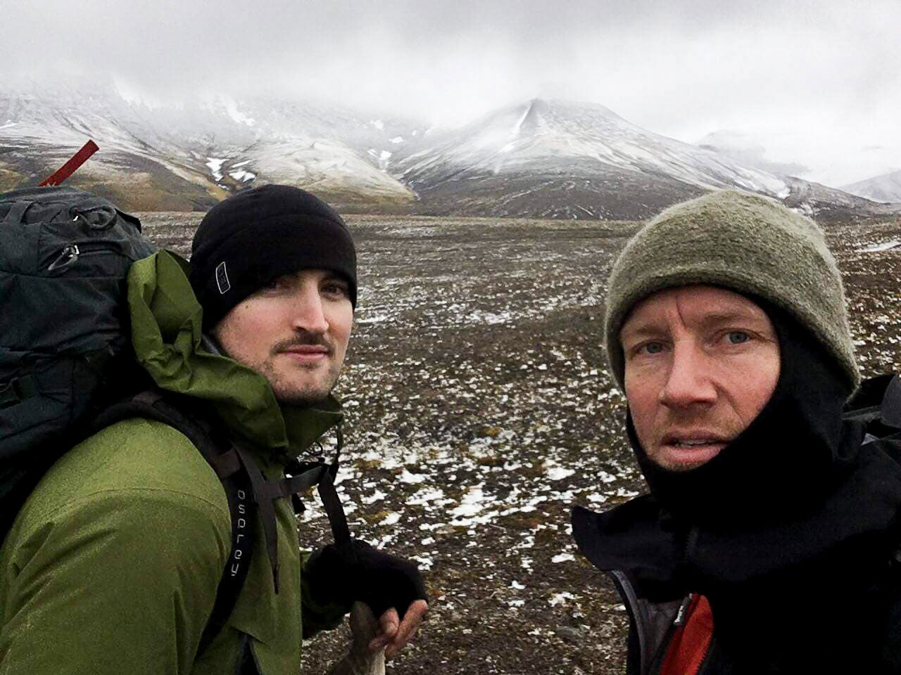
Words and pictures: Matthew McDonald & Marcus Vincent Frostholm
Svalbard has been described as the last true wilderness on Earth. I can’t agree, wild and unexplored places are found the world over, however Svalbard is certainly one of them. With a square area of 62.000 km, it is approximately 1.5 times the size of Denmark while having a permanent population of around 2.200.
However Svalbard is far better known for its population of polar bears, which fluctuate in number from around 3.000- 4.000.
There are very few population centres on Svalbard itself. Being a relatively recently explored island archipelago in the kingdom of Norway, only Longyearbyen, Barentsburg and Ny-Ålesund have populations in any mentionable number, though there are a number of small meteorological and arctic research stations dotted around with a handful of people working.
Reaching Svalbard is not terribly difficult. Flights run daily from Oslo and Tromsø, and we managed to book our return flights from Copenhagen for approximately 2.300 DKK. This was mainly possible due to travelling outside of peak season, which for summer is July and August, and in winter March and April.
Seasons and activities
Svalbard is an incredibly versatile landscape and so many activities are possible here, depending on the season. During summer, kayaking, sailing, and scuba diving are all possible, while winter is dominated by skiing, dogsledding and snowmobiling. However the window for hiking on Svalbard is relatively narrow. Permanent glacier occupies many of the valleys in Svalbard, and the snow is accumulating or too deep from approximately November-May/June. Temperatures on Svalbard can regularly be -30°c in winter and approximately 14-16°C in the summer months. Light levels also vary dramatically on Svalbard, there are months of almost complete and total darkness aside from moonlight, and they run from November to February, whereas 24 hour daylight is typical from the end of April until late July.
Due to the predominantly mountainous landscape and the challenging weather/light conditions, hiking Svalbard is generally confined to June – September, as light is abundant, the ground is relatively snow free and temperatures, although chilly, allow for exploring on foot.
Basic planning and preparation
Any venturing beyond the confines of Longyearbyen comes with the burden of serious planning, going equipped for any eventuality and also seeking permission from the town governor’s (Sysselmannen) office. The ever present risk of encountering bears, on rare occasions even within the town limits, requires that suitable protection is carried in the form of a high calibre rifle, a flare pistol, and in the case of camping, a reliable bear alarm system when heading out of town. You are able to travel to Svalbard with your own rifle with suitable permissions, however for most visiting Svalbard hiring a rifle must first be authorised through application to the Sysselmannen’s office and criminal record check must be submitted along with it.
Depending on your ultimate destination, additional Search and Rescue (SAR) insurance may be required, and in any case, submitting a detailed route plan and all emergency contact information to the Sysselmann’s office is highly advisable.
Our planned hike was originally to go by foot from Longyearbyen to Barentsburg and back, a distance of approximately 120-140km depending on the route taken, with an anticipated duration of 6 days.
Check out this video edit from our trip – “Svalbard 2018: Dark As A Dungeon”:
Our trip
Arrival and preparation
We flew from Copenhagen direct to Oslo, which took around 1 hour, from there we flew directly to Longyearbyen which took around 3 hours. Svalbard’s airport is around 4 km walk from the town and there is a connecting shuttle bus for every flight at a cost of around 50 dkk which collects and drops off guests at all hotels and hostels in the town which is incredibly convenient, given it can be cold, dark and snowy upon landing for much of the year.
Thankfully we had excellent conditions and although very tired, we quickly reach our hostel, Gjestehuset 102, showered and slept, ready for our inclusive breakfast the next morning.
After unpacking, checking our equipment and re-packing, we walked into town to pick up our supply of gas for the week (we opted for 3 x 230 g to give us an extra canister in reserve) and hire our rifle and flare pistol. In the course of renting our rifle and flare gun for the week (1500NOK + 1750NOK deposit) we enquired about any bears having been seen in the area within the recent weeks, to which we were informed polar bears had been spotted in numbers across the whole area within recent days and particularly at locations we were heading to! This made us somewhat cautious and acting upon this information, we chose to purchase extra bullets for security as 10 bullets at that point seemed perhaps under prepared if many warning shots were to be required, plus we could potentially have bears following us in a situation where we were perhaps dozens of kilometres from the protection of civilisation or buildings we could take refuge in. The bears recently spotted included individual bears along the coast as well as a mother and two large cubs 3 days earlier. Upon learning this we also decided to adjust the distance we kept the coast away from us, adding time to our journey but preventing potentially dangerous encounters, day or night.
Having loaded up on the things we couldn’t travel by air with – water, gas canisters, a .308 K98 Mauser rifle (Nazi issue from 1939!), 30 rounds of ammunition, and a flare gun with 5 cartridges, we set off into the wild.
Day 1
The first 5-7 kilometres began by us leaving the town in the same direction we had arrived, walking along the only road out of town towards the airport and further along a track passing some beautiful and picturesque houses along the coast. Having done our research on the habits and habitat of bears, we were already acutely aware of the risk of polar bear attack along the coast. We were exceptionally alert during this period, knowing polar bears main hunting ground is the shoreline, they are difficult to spot when immersed in water and during the summer months their famous yellow-white coats can become dirty, muddy and well camouflaged to better match their surroundings, making them more difficult to spot than in winter time.
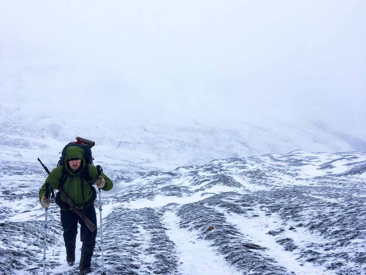
Once out of the town, we entered the aptly named Bjorndalen (Bear valley) and we unknowingly had begun on one of the most gruelling parts of our hike. The valley is long (15-20km) and several kilometres wide, the sides extremely steep around 400-600m, the peaks of the valley encased in snow and ice, like large frosty bath tub. This bath tub shape would frustrate us for the next 1.5 days! Whilst we continued down the valley, crossing streams of freezing water in our sandals and remaining on high alert for bear sightings, we found it very draining to move over some of the terrain as it was characterised by shale and loose rock in many places, testing both our ankles and our hiking boots. Our rucksacks weighed approximately 20-25kg each inclusive of drinking water and our bear protections devices, this was a considerable weight to try and negotiate the scree and loose rock, and we were frequently frustrated by the depth and ferocity of the water making it impossible to cross in places, and the steepness of the valley walls and how unstable the material was. Like spiders in a bathtub, we could not get out. The fine weather had deserted us, temperatures were dropping to around freezing zero, rain had begun, mist had fallen, and we were growing tired having walked around 20km.
Each time we attempted to escape the valley via a narrow gulley, we were thwarted by the steepness, danger of rock slides, or the depth and energy of the small river running through it. Flooded hiking boots at this point in the journey would have been a disaster and we decided not to risk it. Though we did cross the stream at a shallow point in our sandals, this was a painful experience, the water was bitterly cold and fast flowing, stripping the body of warmth and causing immediate pain, we quickly learned this was not something we wished to repeat unless absolutely necessary.
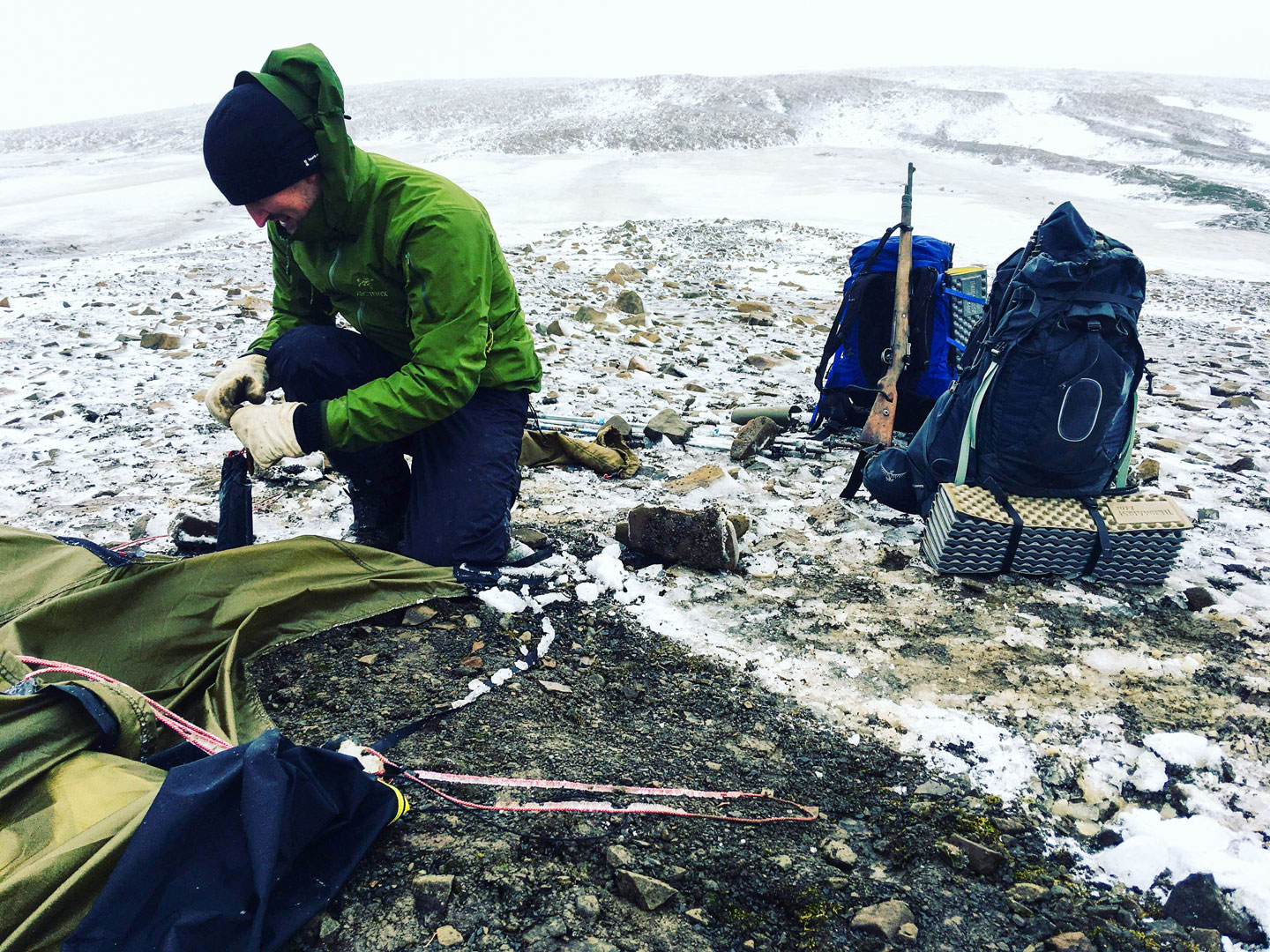
Confident in where we were, and how we would try to escape the valley the next morning, we decided to make camp on a plateau with a good view all around and sheltered rock walls we were confident a polar bear could not traverse, meaning we could concentrate on just one or two directions of approach. We put up the Hilleberg Keron 3 tent relatively quickly and easily, despite being on difficult ground, and we felt very comfortable in the amount of space and ventilation we had inside.
The bear alarm
At this point we assembled our bear alarm system for the first time for real. The bear alarm system had gone through a long design process, despite being relatively simple, it had been taken a lot of planning and refinement. Little did we know the alarm system would be extensively tested on this trip! Importantly, the alarm system had to withstand strong winds, rain, snow, frost, be height adjustable due to varying terrain (mud, soil, rock), be durable so as not to break under strain of encountering rocky ground typical of Svalbard, and also be reliably activated if a polar bear were to make contact with it from any direction. This became a daunting prospect, as the system could be engineered but it also had to be extremely light, not too space consuming for two people to hike with, and easy to set up in nasty weather conditions or darkness. The bear alarm system finally consisted of 4 strong screw-tip fishing bank poles which could provide a height from around 30cm to 70 cm off the ground, two ABS plastic battery operated personal alarm with a pull-pin activation, combined with 20lb breaking strain fishing line which was approximately 1mm in diameter. The entire system weighed approximately 1 kg and took around 20 minutes to set up, which at times tested our patience but this was mainly due to how soft or hard the ground was and having to relocate the poles.
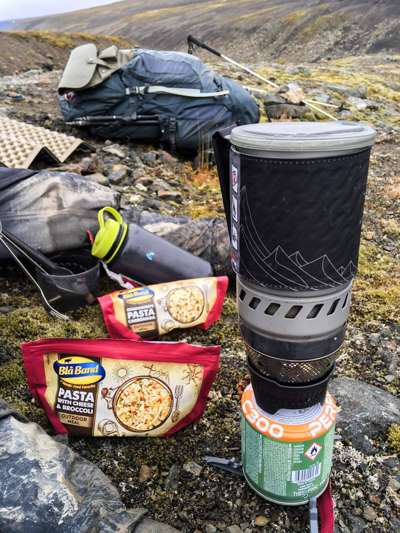
After setting up the alarm system, with our rifle always in one pair of hands, we retired to our sleeping bags and proceeded to make ourselves some dinner with the MSR Windburner. Breakfast and lunch for the tour consisted of Blå Band freeze dried meals, while evening meals consisted of Travellunch double portions, complimented by snacks of protein bars, Rawbite bars and chocolate bars for quick energy and a mood boost during miserable weather
The first night we were both a little uneasy to lay down on the pillow and sleep. The midnight sun wasn’t visible in the sky, but being September the darkness was not upon us. We could clearly see where we had concealed the waste bags from through the ventilation opening in the tent. The waste, particularly empty freeze-dried food pouches were packed in a re-useable trash bag under some stones approx. 100 meters from us and knowing this gave us a powerful urge to constantly watch the surroundings for bears. During the night we woke up 3-4 times alternately and cursed about finding one’s tent mate happily deep in slumber when it seemed so difficult just to catch a few hours yourself.
Day 2
Day two began promisingly, we enjoyed some hot coffee and Blå Band thanks to our trusty Windburner and began the process of de-constructing the alarm system and tent. Despite being challenged once again in escaping Bjorndalen, we managed to traverse a long gulley of several kilometres of scree which was relatively gentle in incline by crossing back and forth across the stream at conveniently narrow points. We were acutely aware that a bear encouter at this point would be extremely unfortunate timing, we would not be able to avoid one another, and turning back from an oncoming bear would mean being pursued all the way back to town. Luckily we managed to traverse the sharp and narrow gulley with no encounters and emerged into a large plain covered in fog and mostly moss under foot. Each day we hiked around 10-11 hours including lunch breaks, and this was no exception. We found remnants of what appeared to be an old track used by vehicles at one point, probably in relation to the construction of Russian mining settlements along the coast, these old twisted pieces of metal and posts along the way guided us to Colesbay and ultimately Colesbukta.
Thick and dense fog was the main challenge of the day, we were not able to navigate with 100 % certainty. We had an emergency beacon with us that was capable of sending a signal in the event of distress/life threatening danger, but this wasn’t able to give us a GPS location and our phones were useless once outside the confines of Longyearbyen. Rain had also damaged our map and we had not brought a map case due to error (we were also misinformed upon ordering the maps that they were water resistant in construction – they were not!).
Our lunch break on day two was brutal to say the least, we were at around 600 m elevation and the temperature had dropped to around -2/-3°C and the wind had picked up, fog had descended to the point the ”track”, which was little more than a slightly muddy line through the moss, had almost disappeared after around 20 metres. We decided to have something warm to eat and drink and wait for the rain and fog to lessen before we resumed. It was bitterly cold and wet, but far from miserable, as we enjoyed a few laughs and we were surrounded by nonchalant reindeer which were grazing moss as we ate our Blå Band.
The fog didn’t let up much and we were compelled to continue by map and compass for several hours, until short breaks in the fog revealed we were a few kilometres from the coast and this raised our spirits. Our ultimate goal for the day, Colesbukta, was deceptively far away, though we could see the bay some 8-10 kilometres walk away. The terrain at this point was very wet and boggy, promoting wet boots, blisters and an overall hard time with heavy packs.
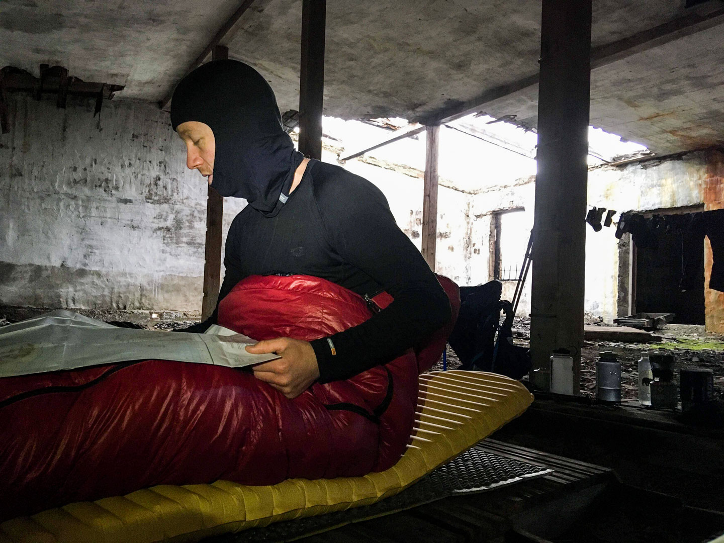
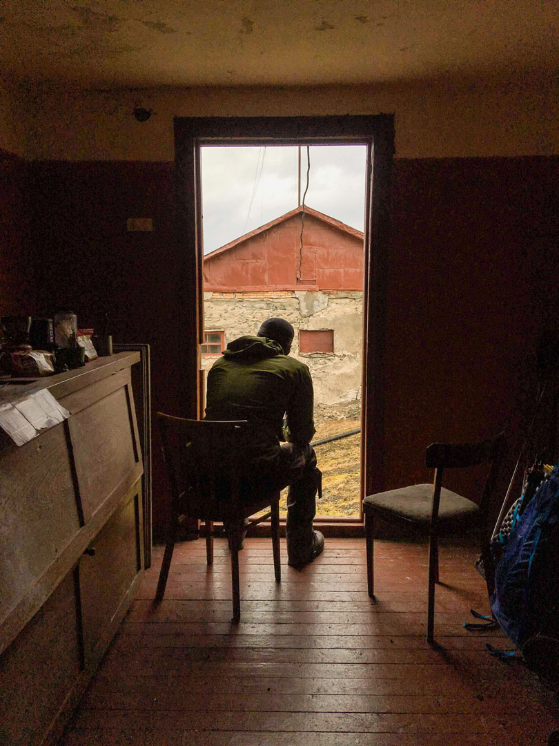
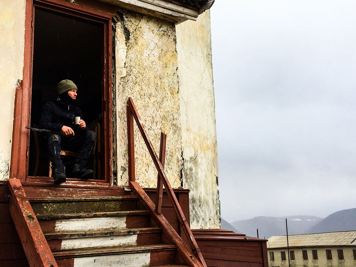
We opted to stick to the trail and this led us gradually down into the bay, where we decided to overnight inside a former Russian warehouse building, abandoned when Colesbukta was abandoned in the early 1960’s. We enjoyed a spot of tea and biscuits in a dilapidated cabin with a beautiful view over the bay, before we made the smart move of barricading ourselves inside the abandoned warehouse. One of the high walls of the warehouse was partially destroyed and could be scaled in the event of a bear breaking down the barricade, so we were extremely safe in this respect. We used a combination of a wooden door, steel beams and concrete blocks and several wooden pallets to construct a wall across the door which would have challenged any heavy animal for a minute or two, and at the very least made a tremendous noise if being investigated, concrete cylinders placed where they could easily fall and made a noise, allowing us to skip putting up the alarm system this night.
The building itself gave us a great shelter, and although cold, allowed us to unpack our equipment, set up a clothes line, dry and and inspect our feet and so forth, which we were very grateful for. We slept on some overturned pallets laid beside each other, with our inflatable sleeping pads on top which provided some warmth and comfort. Though the building itself was cold and bare, it was very ”hyggeligt” in spirit, taking shelter there and being able to look out of the prison-like windows across the beautiful bay, surrounded by mountains. Just a short walk away lay Colesbukta, a former Russian settlement which housed workers and infrastructure for the nearby Grumant mine. Long since abandoned, though showing signs of visitors, we would investigate the next morning.
Day 3
We began day 3 by exploring the remains of Colesbukta town and ruins. First we paid our respects to the cemetery on top of the hill overlooking Colesbukta. This was very sombre and sad as the graves were unmarked and untended in this cold and remote place. We cautiously approached the buildings around the coast, knowing that we were now within very close distance to the waters edge and bears had been spotted here just days earlier and could still be within the area. The industrial buildings had very few belongings but mostly contained scrap metal and dusty objects from the period, work tools and protective clothing from the period, structurally the buildings were in a tolerable condition though there were some signs of collapse and the earth had begun to overgrow some of the outbuildings. Heavy concrete and rusted metal, dusty corridors, but intact glass and furniture in some office rooms. The housing and living quarters in separate buildings nearer the coast were in far better condition and showed signs of recent occupation, probably tourists or guides who visited the area by boat, there were large amounts of personal affects, clothing and household items as well as partially consumed food and some trash from other hikers, that had been left behind.
This was very unsettling and the town had a haunted and ghostly feel to it, discovering half eaten chocolate bars from years earlier only made it more unnerving. We explored for several hours, enjoyed lunch inside one of the buildings while keeping an eye to the coast and watching for patrolling polar bears. It was here where we first enjoyed a sighting of a curious arctic fox, jet white and beautiful in its winter coat, it was quick and nimble and could be viewed from a great distance, though it kept its distance. All too aware of the close proximity of the coast and the growing feeling of unease within the ghost town, we decided to withdraw from the town and begin the journey back to Longyearbyen. Barentsburg was in sight but was still at least 25 kilometres away, the ground and weather was wet and cold and made progress slow going. In addition to the disheartening distance, we knew we had further potentially treacherous river crossings before we reached Barentsburg, and this put us in peril of not making it back in time for our return flights and other commitments. Time was simply too short to be certain we could manage it and not risk bear encounter along the coast, exhaustion or running out of supplies. An 8 day trip would have made the journey comfortably possibly but 6 days is all that we had time for so it was time to begin the hike home.
Colesbukta lays next to the coast so we began the arduous and challenging climb back to the higher ground we had enjoyed the previous day. Though we made good progress physically, it was quite punishing, particularly due to the high exertion, heavy packs, and the weather which made alternating between light clothing and shell clothing necessary. The ground was again very saturated on the way back, making progress slow and soaking Marcus’ leather boots. I enjoyed relative dryness in my Gore-Tex hiking boots but was punished by some blisters around one heel which I had picked up earlier on. We hiked across wet rocky moorland for what seemed an eternity, before we encountered a group of 5 hikers from Belgium, who had set out earlier from Longyearbyen. We were elated to meet other people after approximately 60 km of hiking not seeing another soul. We exchanged brief stories of the wildlife we had seen along the way, and they were particularly excited to hear we had seen several arctic fox at this point, and none of us had spotted any polar bears in the area in the last two days so we felt more confident that evening of a low chance of a bear encounter.
Through fatigue, fog and temperatures dropping below freezing, we decided to make camp around 9 pm. It was becoming dark and we set up our tent relatively simply, though the ground was saturated and mushy in the area we set up the alarm system poles. We re-inforced the tent pegs with the abundance of heavy rocks that were in the area and did the same for the alarm system and retired into bed, a little chilly around midnight. There was a flock of 7 curious reindeer in the area that were inquisitive but we managed to shoo away without tripping the alarm system. Little did we know this night would prove to be the most challenging of all.
We had chosen a spot on a flat moorland, close to a small ridge, above the steep valley that led to Grumant. Though foggy and dark, we had a good idea of where we were and close to the track leading us around the mountain and to where we would do battle with Bjorndalen again the next day. Around 01.30am I was awoken to the sound of the tent being struck on one side by a very strong wind that only continued to build and I immediately knew we were in real trouble. The wind was shaking the tent violently and I woke Marcus with some expletives very concerned. We had been hiking a solid 10 hours previously at least and had only enjoyed 1 hour of sleep at this point, the temperature was now around -3 plus windchill, and it was beginning to snow combined with the high winds. The tent was being strained and practically crushed under the merciless wind, pushing the walls over to the one side and rattling the poles. Both Marcus and I supported the walls of the tents with our arms while sitting upright in our sleeping bags to remain warm. This helped us ride out some of the worst moments of the storm for around 4 hours before we were forced to retire and get some sleep and hope that we had done enough hard work securing the tent and alarm system during set up to last until daylight came and we were semi-rested. We were also totally aware that the alarm system now may have been destroyed or disabled by the high winds. If we had had to emerge from the tent to defend ourselves from a polar bear this night, we would be at a severe disadvantage, cold and exhausted and to repair the alarm system in the event of a false alarm due to wind would be very punishing in terms of wet and lost body heat. Despite having cold, calm conditions during the tent set up, lessons were learned.
Day 4
The following morning we woke up to several shocks and surprises. The landscape had completely changed, what was previously wet and saturated moss and rocky marshland, had been replaced by frozen soils and frost covered rock. This actually turned out to be to our advantage walking as we made faster progress over the frozen hard ground than we did on the soft wet ground. To our amazement the alarm system had survived the horrendous winds and still functioned, despite being nearly completely frozen in place and the fishing line weighted down with ice. The tent pegs and guy lines from one side of the tent had been ripped from the soil despite being covered by heavy rocks, however the tent had survived admirably and had kept us safe and warm through the night. The 5 Belgian hikers we had met the day before had overnighted in a hut and were clearly surprised to learn we had planned to overnight in a tent. Admittedly in retrospect choosing a tent again for that night would not be for the faint hearted.
We enjoyed a warm breakfast, some hot chocolate and packed up carefully in reverse despite the high winds, careful not to lose any precious equipment and still watching constantly for bears that could appear through the mist/fog.
We made excellent progress this day, despite the ground being confusingly covered in snow, we found our way back down into the valley, choosing to travel down the opposite side of the valley this time around as it seemed plagued by fewer small streams and valleys if we could remain on higher ground. We made fast progress over the frozen ground, and there was abundant fresh water from snow and ice on the ground. We always elected to use the MSR Mini-works filter we had with us due to the abundance of reindeer and bird droppings around which could contaminate the water, plus we encountered carcasses of deceased animals, hunted and from natural causes. The small rivers and tributaries were running high again due to heavy rainfall, glacial melt and condensed fog, but we managed to make it across to where we hoped to go without too much issue.
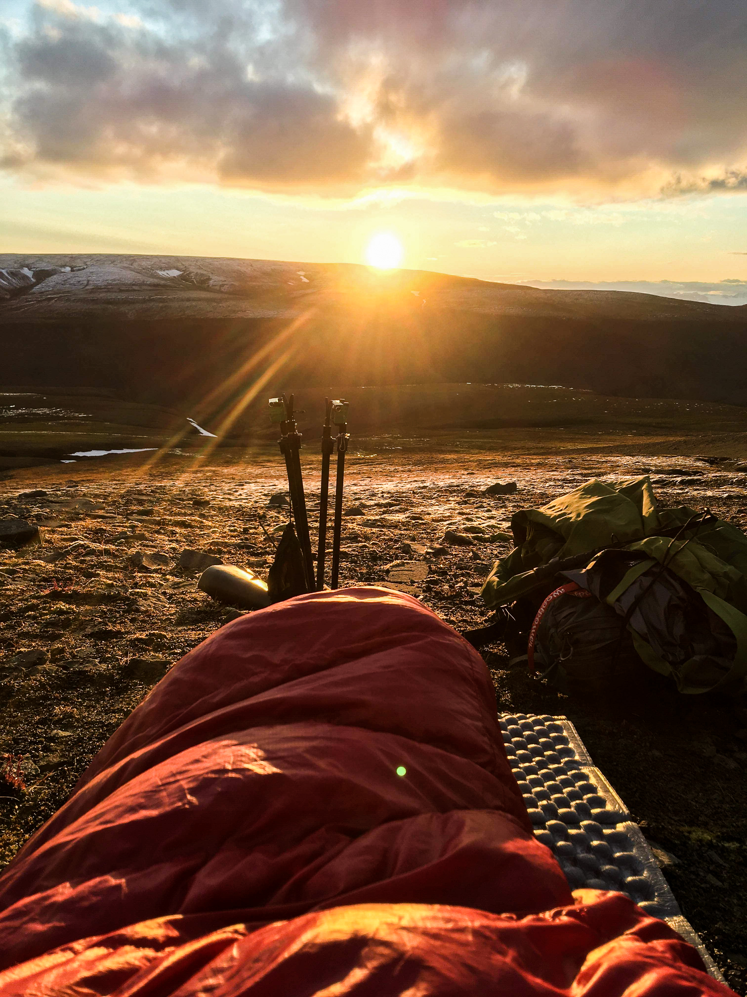
Bjorndalen is deceptively lengthy to hike and it was going to once again take a solid day or more to exit. We decided to preserve the height we had accumulated and not come down into the lower valley but to camp in the shelter of the upper confines of the valley alongside the arctic ptarmigan, which we discovered in their winter camouflage. Despite having slept perhaps only 4 hours we managed to cover excellent distance, spurred on by the fact despite the fog we knew our precise location and we were on the home stretch. We decided to set the camp up a little earlier in the evening and enjoy the first evening we had had with sunshine, which gave us a beautiful panoramic views of the entire valley. Little did we know we were about to make another casual mistake which would cost us our comfort dearly.
When we finally found peace and calm in our sleeping bags, it quickly dawned on us that despite having spent time finding a clear place for the tent on the plateau, it was sloping just a little too much and we would gradually slide downwards on our mattresses into the foot end of the tent. This was undoubtedly the worst decision of the day. The wind laid off and we were early in our bags after very little sleep the previous night, so considering the struggle that lay ahead for the coming night, we could only laugh and regret the situation we had put ourselves in. Taking down the alarm system and tent to move everything was not an appealing option and we reluctantly accepted another poor night’s sleep due to our error.
Day 5
On the last day of the hike we woke up at the bottom of the tent, fatigued and in fits of laughter which was sure to keep any bears away. What a night! It remained cold and icy, but the wind had calmed down a bit and a promising day lay ahead of us. We remained at as high an elevation as we could along the Nordenskioldfjellet to take advantage of hiking the frozen and solid ground. We were not quite sure what we could expect from the terrain up here, as we had walked through the lowest part of Bjorndalen valley on our departure. If there was something we had learned by this point of our trip through Svalbard, it was that you could not count on anything else than it (and we) would become “tougher than the rest”. We even invented a dedicated term called “Svalbard-easy”. This phrase best described anything that outwardly appeared possible or perhaps even the simplest, easiest possible route/method, but in fact turned out to be brutal, exhausting and on the edge of barely possible, forced to make work due to sweat and perseverance! This term was regularly applied to finding a passable route out of the steep rocky valley or across an icy river flow.
Especially draining was the tundra, characterized by the underlying permafrost and soaking, saturated mosses that could sink very deeply if stood up. It made it hard to walk when regularly sinking into the mud and small puddles that would regularly reach up to your calves. When it wasn’t the tundra that slowed our advance, it was the extremely rocky terrain that appeared in all the corners of this wilderness. Often loose underfoot, and with little moss or soil above or between it, the risk of slipping, sliding or falling was constant, and it was hard work on both the feet and the ankles with awkward angles and no absorption for your heavy steps. Such was the landscape all the way to and from Longyearbyen. We had now come to such an elevation point that the rifle was put under the top cover of the bag and the same with the flare gun, so we could easily pull weapons from each other’s bags. We weren’t careless, but we felt more secure so high up in the mountains with nothing to living to see on the ground for miles around.
We still met occasional herds of reindeer, but now we also encountered the Arctic Ptarmigan, different species of partridge like birds that live in very cold climates. The ptarmigans that live on Svalbard clumped together and sat completely silent in their perfect winter camouflage. Occasionally, when the fog dissipated, we could again see the water in the Isfjorden, but there was also something else that caught our gaze. At the top of the Platåberget, which we could see in the distance, there were a myriad of huge big dishes that looked straight out of a James Bond film. This, of course, gave us the immense urge to investigate. It turned out to be Svalbard Satellite Station (SvalSat) which was established in 1996. The world’s largest commercial ground station with more than 31 state-of-the-art multi-mission and dedicated antenna systems. This was our final stop on the way home to Longyearbyen.
After this tour’s last freeze-dried lunch was eaten in the shelter provided by the lee of a satellite station, we were picked up by some researchers who gave us a lift down towards Longyearbyen. As it turned out it was permitted to move around the satellite stations, but not to use the dirt service road that we had in mind, that was reserved for research/industrial vehicles. We were asked to unload the rifle before we hopped in the 4X4 pick-up truck, and we were only too happy to oblige, both now feeling very competent in handling the rifle.
When we reached Longyearbyen and found our hotel for the night we sat down directly in the lobby to get a cold beer and toast to an amazing trip! Behind us, we overheard news on the polar bear front. It turned out that a female with two cubs had just been spotted in Longyearbyen not long after we had arrived back, and they were now on their way out of town. People were asked to leave them alone and not seek it out, as it would stress them and they needed their food and rest with winter approaching. The polar bear and it’s two cubs had come to Longyearbyen along the coast also via Bjorndalen. We thought it was fantastic!
The end!
Facts about Svalbard
How to get there:
Fly directly from Oslo or Tromsø (duration approximately 3 hours)
Cost: 2.000 – 5.000 return, depending on season
Population: Approximately 2.200
Largest settlement: Longyearbyen
Airport: Longyearbyen: 3-4km from the centre of town
Currency: Norwegian Kroner
Language: Norwegian/English
Summer temperature: Daytime 12-16 degrees celsius
Winter temperature: Daytime -10 to -30 degrees celsius
Hiking requirements
Hiking Svalbard is only really possible during the summer/autumn months. At all other times the lack of light or presence of deep snow/extreme cold makes hiking virtually impossible, while skiing and snowmobiling are the transport modes of choice.
To leave Longyearbyen town, one is required to carry a rifle and bear scaring equipment such as flare guns and a trip-wire alarm system if camping. To obtain permission to rent a rifle one must first make contact with the town governor (Sysselmannen) office and submit relevant paperwork including a plan of the hiking route and relevant documentation such as a criminal background check in order to obtain permission to hire a rifle/safety equipment. Depending on where you are planning to go, Search and Rescue (SAR) insurance may be required as part of the Sysselmann’s permission.
Our costs
- Week’s rental of a 30-08 Mauser rifle including 10 bullets – 1000 NOK
- Week’s rental of a flare pistol – 500 NOK
- Refundable cash deposit for both – 1750 NOK
- Extra ammunition – 375 NOK
- Gas canisters 3 x 230g – 200 NOK
- Flight tickets – 2.200 DKK
- Hostel/Hotel stay for 2 nights – 1.200 DKK
- Total trip cost per person excluding food/drink: 4.200 DKK
Things we would pack differently
• Pack a few extra items of warm clothes. The weather turned colder on the fourth day, so having a warmer pair of gloves or balaclava would have been helpful
• Additional blister care kits. We had 5 of mixed sizes and this was insufficient for larger blisters
• Gore-tex boots instead of pure leather. The ground was wet and very saturated, becoming boggy and muddy in many places, this is typical of the time of year due to warmer weather and snow melt. Gore-tex boots would have been helpful here.
• A waterproof map case. Our map became damaged by rain and this was easily avoidable
• Additional snow/sand pegs for soft ground
Lessons we learned
• Stop and set up camp before you are tired. Once you are exhausted, setting up camp in the cold and dark is not sensible, mistakes are more easily and the experience becomes a negative one.
• Make sure the camp site is close to perfectly level. Otherwise it can ruin an otherwise good night’s sleep, especially if your mattress has a smooth surface.
• Music/singing really improves your mood and gives you motivation, especially during the challenging moments with weather etc.
• In the case of hiking Svalbard, make sure you always have your weapon physically with you, that it is loaded and well maintained. It could be needed at a moment’s notice. Stay alert and assess your surroundings at all times. Share out tasks and do them one at a time with one person keeping watch.
• Adapt your plans to the weather and your own physical limits as you go. Assess the safety of your actions before you do them, there may be a safer route a little further. Getting injured while hiking Svalbard could quickly become life threatening, so don’t cut corners or take chances due to tiredness/frustration.
Indholdsoversigt